Figures & data
Figure 1. Location map for Gilf El Kebir studied area with seismicity ML > 4 from 1970 to 2022.
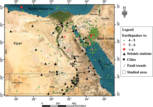
Figure 2. a) geological map modeified after Egyptian Mineral Resources Authority (EMRA) Citation2008 b) focal mechanism solution of earthquakes in the studied and adjacent areas, and in the Gebco (Citation2019) digitial elevation model base map (Tozer et al. Citation2019).
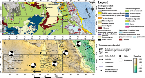
Table 1. Focal mechanism solutions used in this study and adjacent areas for earthquakes with magnitude (ML)>4.6.
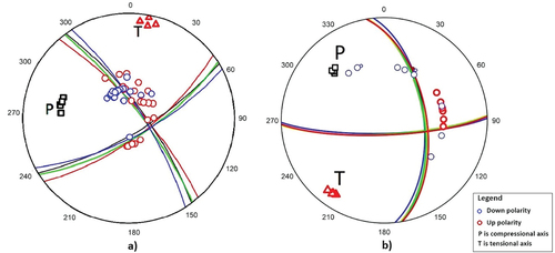
Figure 3. a). 9 December 1978 earthquake, M5.3, b). 19 February 2021 earthquake, M4.6.