
Dear Readers, with great pleasure and admiration, we extend our warmest congratulations to the brilliant cohort of nineteen PhD, MSc, and Honours students from eleven esteemed Australian Universities on the successful completion of their theses. The culmination of their dedicated efforts and intellectual prowess marks a significant milestone in their academic journey and contributes immensely to the field of exploration geophysics.
In the following pages we invite you to delve into the detailed summaries of these exceptional theses, each a testament to the depth and diversity of research within our community. From innovative approaches to geophysical exploration to groundbreaking discoveries that push the boundaries of our understanding, these students have exemplified the spirit of inquiry and excellence that defines the geophysics field in Australia.
As we celebrate their accomplishments, we also acknowledge the invaluable guidance and support provided by mentors, faculty, and the broader geophysical community. It is through collaboration and shared passion that we continue to advance the frontiers of exploration geophysics.
Join us in recognising these emerging leaders and their contributions to our field. May their achievements inspire future generations of geophysicists, propelling us toward new heights of scientific discovery and technological innovation.
Theses in geophysics completed in 2023 PhD theses
Shubham Agrawal, Australian National University: Seismicity and structure of the eastern Gawler Craton and Lake Eyre region.
Kati Thanda-Lake Eyre represents the lowest point and the largest lake (when filled) in Australia. Located northeast of the Gawler Craton, the region is associated with pronounced intraplate seismic activity and thick sedimentary cover, potentially obscuring the elusive boundary between older Proterozoic and younger Phanerozoic eastern Australia. Despite this, the area had limited seismic data coverage due to its remoteness and the harsh arid climate, creating a seismic coverage blind spot in the centre of the Australian continent. To address this, two seismic arrays were deployed from 2018 to 2022 - the Lake Eyre Basin array and AusArray-SA array, which provide the basis for this thesis.
One of aims of this thesis was to understand the seismic signature of sedimentary layers within South Australia using receiver functions. Three-quarters of the Australian continent is covered by a blanket of sedimentary and regolith material and estimates of sedimentary thickness are therefore essential to begin to explore beneath the sedimentary cover. However, active-seismic methods such as reflection imaging can be prohibitively expensive, particularly in remote areas. Therefore, to address these challenges, we utilise seismic stations in South Australia to determine basement depth based on the arrival time of the P-converted-to-S phase at the boundary between the crustal basement and sedimentary strata. By establishing a predictive relationship between Ps arrival time and basement depth using borehole data, we provide a way to obtain an initial estimate using relatively low-cost and portable seismic stations.
Using this shallow structure information, the thesis investigates the Moho topography beneath the region. Many of the recently deployed stations are located on such low-velocity sedimentary basins, leading to high-amplitude reverberations in the receiver function signal. We employ a resonance removal filter to reduce the sediment reverberation effect, facilitating detection of the P-to-S conversion from the Moho, and providing new insights into the crust of an under-explored region of South Australia.
Finally, the thesis focuses on understanding the occurrence of earthquakes in the Lake Eyre region. Intraplate seismicity can pose a significant risk as it is often non-periodic, poorly understood, and sporadically recorded by sparse seismic networks across vast continents. Within Australia, the distribution of intraplate seismicity is non-uniform but instead tends to concentrate along weak zones of increased activity, such as, the eastern margin of the Gawler Craton in South Australia. Over 130 new local events have been recorded that would otherwise have gone undetected by the national network. After relocation, the pattern of earthquakes becomes more spatially defined and appears closely tied to a trans crustal scale fault system at the edge of the Gawler Craton. Interestingly, earthquakes follow the natural spring system in the region associated with the edge of the Great Artesian Basin, indicating a possibility of fluid-assisted hydrofracturing. Thus, this thesis provides new constraints on the crustal structure of a hitherto under-explored region in the heart of the Australian continent and contributes to the ever-increasing global understanding of intraplate earthquakes.
Auby Baban, Edith Cowan University: Carbon geo-sequestration and enhanced oil recovery in geological formations: Multi-scale analysis.
Carbon Geo-sequestration (CGS) is a key component of the net-zero approach of achieving the global decarbonisation programme by 2050. When combined with Enhanced Oil Recovery (CGS-EOR), it is an economically appealing technique as it offsets a fraction of the expenses associated with CO2 extraction. However, despite recent cutting-edge technical research, predicting quantitative CO2 trapping in geological formations via capillary trapping remains enigmatic. Moreover, physical underpinnings of several aspects of multiphase flow characteristics of CO2/brine/rock systems, that greatly impact carbon capture and containment security, require further investigations.
Nuclear Magnetic Resonance (NMR) is of particular interest when investigating the petrophysical characteristics of multiphase flow in porous media as it is highly sensitive to pore scale rock-fluid and fluid-fluid. From T1-T2 2D images and T2 relaxation time, conclusions regarding Porosity, Relative permeability, Pore-Size Distribution (PSD), Saturation (Sw) and thus residual CO2 saturation (SCO2,r) can be inferred.
This thesis investigates laboratory core flooding measurements with data collected on water-wet (hydrophilic) and oil-wet (hydrophobic) sandstone and carbonate formation rocks under reservoir conditions. I was specifically focused on the pore-scale (micro-scale) fluid physics in a multiphase flow pore network due to its significant impact on the Darcy-scale (macro-scale) flow functions and, ultimately, on the reservoir-scale CO2 residual trapping and oil recovery factor. I used the robust in-situ NMR T1-T2, 2D images to visualise fluid configurations in the pore-space and utilised T1/T2 ratios to assess the microscopic wettability of the rock to pore-space fluids subsequent to displacement processes. The T2 relaxation time was measured to assess the corresponding rock/fluid interplay at the pore level, analyse the trapping behaviour, and demonstrate displacement mechanisms, all of which are directly connected to field flow functions.
In two-phase flow systems, water-wet samples consistently demonstrated greater residual CO2 trapping than analogous oil-wet cores. Comparable results of CO2 trapping were observed in the three-phase flow systems, although certain aspects are different, and displacements are significantly complex. Furthermore, the oil recovery factor in oil-wet cores was substantially lower than that of analogue water-wet cores.
Finally, a thorough and self-consistent dataset that significantly impacts the CO2 storage in saline aquifers and in hydrocarbon reservoirs is the end result, demonstrating how physicochemical characteristics (wettability) adjustment at the pore scale causes large-scale declines in trapping. These significant innovative advancements emphasise the importance of CGS as an integral part of net-zero missions and CO2-EOR project designs relative to reservoir-scale implementations in terms of budgets, delivery of additional energy resources (more oil recovery), and storage capacity and containment integrity.
Ao Chang, University of Queensland: Full waveform inversion with random mixing.

Full waveform inversion (FWI) is a high-resolution velocity modelling technique used to image subsurface geological structures. The velocity profile is one of vital physical information to identify the properties of medium. The conventional ways to conduct FWI can be gradient-based optimisations, Bayesian frameworks, or even evolutionary algorithms based on stochastic theorem. The optimisation methods are usually driven by minimising the misfit between the observed and the simulated waveform data on the current model to update the velocity model iteratively. The common issue of this method is easily being trapped into local minima, highly depending on the quality of an initial model. In order to validate different methods, the easiest way to obtain an initial model is a smoothed version of real velocity model (which is impossible in reality). Speaking of inversion, it always represents the non-unique solutions due to its non-linear and ill-posed problems. Bayesian provides an alternative option to bring uncertainty quantification of inverted models in instead of a “best-fit” solution. But FWI is of complexity and multi-parameters involved, the intensive computation cost becomes an inevitable issue to deal with within the Bayesian framework.
My thesis is aimed to apply a geostatistical algorithm called Random Mixing (RM) for FWI. It takes advantages of spatial correlation of the unknown velocity field represented by variogram and univariate marginal distribution as prior information to guide the inversion, the univariate marginal distribution can be represented by any parametric or non-parametric distribution function. The prior information can be acquired easily according to literature, experimental knowledge or direct observations. Meanwhile, RM allows for uncertainty quantification based on sets of inverted realisations by means of variance. The realisations generated here are possible velocity models of the assumed variogram and marginal distribution, and all observations are reproduced to some accuracy. Thus, a multitude RM running can be regarded as sampling from the random field which is modelling the solution space of the inversion problems. The probability density function for each element can be characterised by calculating and visualising element-by-element moments. The spatial distribution of the mean and standard deviation across a group of realisations are shown as uncertainty within the solution space. Inside the inversion processing, RM reduces the computation cost through reducing the number of forward models running. It is achieved by transforming the objective function into single components and get optimal estimation via Whittaker-Shannon interpolation.
The first model is built up with an added anomaly represented by regular sinus pattern on a homogeneous field to investigate the survey depth and feasibility of the algorithm. Then a spatial random field with an anomaly body is generated and tested for the same purpose. The mean fields of RM realisations are able to deliver good estimates for the velocity. Both of two models illustrate the significance of the accuracy of the spatial characterisation (even though the accurate ones are not possible in real work). So as the further work, well log data is added as linear constraints to estimate the prior information and drive inversion processing with seismic observations together. The virtual well logs are drilled with an equidistance along the survey line where the seismic survey covers. The experimental spatial parametrisations are estimated from well log velocity data samples and fitted into theoretical spatial functions to get best-fit used for the following inversion. Through RM, the linear information can be added on the inversion processing in a straightforward way rather than into the objective function as a regularisation. At the same time, the uncertainty across the realisations can be reduced via being constrained by direct observations. The tests with estimated prior information are implemented on the same previous random model for comparison. The results with combination of both linear and non-linear constraints with estimated prior information can reach to the similar level of results which are inverted by individual seismic observations with accurate prior information. Even without seismic observations, the individual well log data with estimated parametrisations can still lead to satisfying results when the vertical sampling interval could cover the spatial correlation length. Furthermore, an anisotropy multi-layered model with a tilt is generated to test RM for a strong spatial anisotropy. The velocity data returns a velocity distribution reproducing the geometry of the tilted structure with high accuracy, which validate RM’s ability for complex geological structures.
Youseph Ibrahim, University of Sydney: Investigating the dynamic drivers shaping fold and thrust belts from plate margins to intracontinental settings.
This thesis investigates the dynamic processes behind the formation and evolution of fold and thrust belts in conventional plate margin settings and non-conventional intracontinental settings. The main research questions are: (1) How do pressure gradients derived from the thickening or thinning of the crust influence the genesis and evolution of fold and thrust belts? (2) How does the rheology of the lithosphere influence the architecture of an overlying fold and thrust belt? (3) How does structural and thermal inheritance influence the architecture of fold and thrust belts? (4) How can fold and thrust belts form in an intracratonic environment? This thesis consists of three manuscripts that address these questions.
The first manuscript explores how the interplay between tectonics and isostasy influences the first-order development of fold and thrust belts. Numerical experiments highlight the contrasting isostatic response of a ductile hot lithosphere (e.g., hinterland within continental crust) versus a rigid cold lithosphere to the loading of an overlying fold and thrust belt. We find that when isostatic adjustment is facilitated through ductile flow, shortening is localised in narrower regions. This results in a narrow and thick fold and thrust belt with complex internal architectures. When isostatic adjustment is facilitated by lithospheric flexure, fold and thrust belts have greater relief and are laterally extensive, with an internal architecture consisting of structural repeats. The findings are juxtaposed with the Subandean zone, illustrating the different structural patterns observed in the Bolivian and Peruvian regions due to their varying isostatic responses driven by their distinct crustal rheology.
The second manuscript contrasts the formation of fold and thrust belts from the inversion of narrow and wide rifts. Modern geotherms favour narrow rifts, while warmer Archaean and Proterozoic geotherms favour wide rifts. Through numerical experiments, we explore rifting under different geotherms, followed by compression either immediately post-rifting or after a quiescent cooling phase. Narrow rift inversion encourages foreland basin development adjacent to the fold and thrust belt. Extensional faults reactivate at the centre of the model and new faults propagate in the adjacent foreland basins. Wide rift inversion, however, sees broader fault reactivation and a widely distributed fold and thrust belt. In wide rifts, when contraction immediately precedes rifting while the lithosphere is warm, the ductile lower crust and lithospheric mantle thicken homogeneously, resulting in a flat Moho. Thrusting is limited to the top few kilometres of the upper crust. Conversely, the inversion of thermally relaxed wide rifts involves faults that cut across the lithosphere and offset the Moho by 10-30 km, as a result of the embrittlement of the lithosphere. Comparisons are drawn with the Colombian Eastern Cordillera and Centralian Superbasin.
The final manuscript explores the central Australian Alice Springs Orogeny, a unique setting in which an orogeny forms deep within the interior of a craton. We use a combination of fieldwork, geochronology, and numerical modelling to explore the strange occurrence of a high-grade gneiss dome (Entia Dome) adjacent to a series of nappes and duplexes (Arltunga Nappe Complex) within the eastern Arunta region. Structural data show a structural continuity from the Entia Dome to the Ruby Gap Duplex. Geochronology at key sites confirms the exhumation of the dome to be synchronous with deformation in the Ruby Gap duplex and Illogwa shear zone between 340 and 310 Ma. We present a model in which an extensional domain, comprising the Entia Dome, and a contractional domain, that consists of the Arltunga Nappe Complex, are linked by a translational domain containing the Bruna décollement zone and Illogwa shear zone. Our numerical experiments show that high horizontal gravitational stresses, driven by the substantial pressure gradients introduced by the 35 km deep Harts Range rift, lead to the convergent gravitational collapse and inversion of the Harts Range rift. This initiates the exhumation of the Entia Dome and the sliding of cover sequences forming gravity nappes, isoclinal folds and the thrust systems that make up the Arltunga Nappe Complex.
This thesis introduces new insights into the role of gravitational forces, lithospheric rheology, and the thermal and structural inheritance of rifts in the evolution of fold and thrust belts. We present the first example of major deformation attributed to contractional gravitational collapse in central Australia and open new dialogues about the tectonic drivers influencing the development and architecture of fold and thrust belts in intracratonic and plate margin settings.
Roman Isaenkov, Curtin University: Continuous borehole seismic monitoring of carbon dioxide storage.

Active time-lapse seismic monitoring technology is essential for carbon storage projects due to its ability to track the CO2 plume evolution in space and time. The standard industry monitoring approach (known as 4D seismic) is to acquire one 3D seismic survey before injection (baseline) and a series of monitor surveys during and after injection. Assuming that nothing in the subsurface has changed except CO2 reservoir properties, a comparison of baseline and monitor surveys is supposed to highlight the presence of CO2. However, such surveys can interfere with other land users and require on-site crew and equipment, which becomes expensive over years or decades of monitoring. These factors limit the frequency of repeat surveys to one or a maximum of two per year – and this may miss critical processes such as CO2 leakages or fault re-activations.
These limitations may be addressed by a permanent seismic reservoir monitoring (PRM) system with permanent sources and receivers, which can track subsurface changes in near real-time over decades. Permanent sources can be installed on the surface or in shallow boreholes. Permanent receivers can be buried in trenches or also installed inside wells. Borehole installations are often preferred as this approach minimises the influence of weather and variable near-surface on sources and receivers. Permanent installation minimises land access requirements, allows automatisation of the system (crew is not required), and can be frequent (in some cases – daily). However, the main PRM limitation is the high installation cost, as a lot of equipment is required to run the project in the first place.
Permanent monitoring is still in its infancy, and as such, no standard PRM design exists. This is mainly due to the different tasks and different available equipment each project has. As such, there is no standard way to automate data acquisition, storage and processing - each project can have some unique new features. The work of this thesis aimed to develop automated data acquisition, storage, processing and interpretation of PRM data acquired at the CO2CRC Otway Stage 3 project with the main focus on data processing. The work is published in five publications.
The thesis describes the acquisition setup, on-site data storage solution, processing and assessment of PRM’s initial repeatability. The initial data processing compresses the data from 1.3 TB/day to 500 MB/day, providing good repeatability over the half-year period. Later, we improved the initial workflow and presented monitoring results and their comparison with high-lateral-resolution 4D VSP data. We detected the CO2 plume on the second day of injection and monitored its evolution over more than a year of monitoring.
Monica Jimenez, University of Adelaide: Post-breakup evolution of the Ceduna Sub-basin and understanding of processes that occur on rifted continental margins.
Understanding the characteristics and evolution of normal growth faults has proved critical for interpreting the geological development of delta systems and the petroleum system of sedimentary basins within passive margins. In general. normal faults control the distribution of sedimentary deposits, the stratigraphic architecture and can provide migration pathways or traps for fluids (e.g., water and hydrocarbons). The interpretation of 3D seismic surveys has permitted a better understanding of fault evolution and control the migration of fluids. However, there are still knowledge gaps regarding the variability of normal growth faults geometrical features (length, strike, dip angle and displacement), fault evolution, changes in the distribution of sediments near the fault planes, and variation in the risk of fault reactivation and their control on magma flow.
This project consists of four chapters that detail the structural complexity of normal growth faults in the Ceduna Sub-basin (Great Australian Bight Basin) and provide a detailed interpretation of the Ceduna 3D MSS seismic survey, an analysis and discussion of the normal growth fault complexity in terms of fault evolution, potential risk of reactivation, and influence the transport of magma. The seismic interpretation used in this study permitted a detail characterisation of 530 normal growth fault segments in terms of displaced sedimentary sequences, length, dip angle, strike, and changes in displacement along the fault plane. This study classifies these faults segments in the Ceduna Sub-basin in three different fault groups related to the displaced sequences and includes three different analyses: (1) Fault kinematic analyses to assess three different evolution styles that include constant growth and reactivation by either dip-linkage or reactivation during the deposition of upper sequences. (2) Assessment of risk of fault reactivation using the fault analysis seal technology to demonstrate that areas of the fault with steep dip angles and oblique strikes from the current maximum horizontal stress are at higher risk of reactivation. (3) Interpretation and statistical lineal alignment prediction to demonstrate the substantial control that normal growth faults have on the geometry and emplacement of eruptive centres magma, flow regions and intrusions.
This is the first study in the Ceduna Sub-basin to include a 3D seismic data that extends 12 030 km2 to understand the variation in geometrical characteristics and the variability in the fault evolution of normal growth faults, exposing differences in their evolution styles and the importance of the detachment in the fault displacement configuration in delta systems. It established the importance of the changes in the fault roughness in the prediction of fault reactivation where regions of the faults with steeper dip angles and oblique strike orientations are at higher risk of fault reactivation. It also demonstrates that normal growth faults strongly influence the transport and emplacement of magma by stablishing a preferential northwest-southeast alignment between igneous bodies and the fault strike orientations.
Joel Kumwenda, Monash University: Basement architecture of the North Australian Craton.

The North Australian Craton is a significant component of the Australian continent, with its basement geology older than 1800 Ma. This basement geology is mostly concealed beneath Paleoproterozoic, Mesoproterozoic, and Cambrian sedimentary and volcanic cover. This thesis focuses on uncovering the hidden basement geology in the interior of the North Australian Craton and how this basement influenced the overlying basin architecture. Using potential field, seismic reflection, and existing isotopic, geochronological, and geochemical data, this study defines the basement crustal structures in the North Australian Craton.
A review of U-Pb inherited zircon ages and Neodymium geochemical data for pre-1800 Ma magmatic rocks provided insights into the nature of the basement of the North Australian Craton. Despite local variations in magmatism, basin systems, and deformation between the blocks, they share similar geologic evolution, magmatic history, and sedimentary provenance, indicating that they were part of a contiguous proto-North Australian Craton prior to the ca 1870-1850 Ma Barramundi Orogeny.
Lineament analysis of gravity and magnetic data reveals the composite nature of the basement in the interior of the North Australian Craton. Five distinct crustal elements are identified: Pine Creek, Arnhem, North Tennant Creek, Tennant Creek, and Tanami-Altjawarra. The Pine Creek, Tennant Creek, and Tanami blocks represent the exposed parts of the Pine Creek, Tennant Creek, and Tanami-Altjawarra, separated by major crustal boundaries interpreted as tectonic sutures. These crustal elements and their boundaries exhibit linear to curvilinear geometry typical of accretionary orogens in modern plate tectonic settings.
Geophysical interpretation and seismic reflection constrained forward gravity and magnetic data modelling shed light on the basement architecture of the Tennant Creek Block at the centre of the North Australian Craton. The forward modelling reveals predominantly WNW-trending faults, defining a half-graben, filled by sedimentary rocks of the ca 1840 Ma Ooradidgee Group. The west-northwest-trending structural grain of the basement is not reflected in the overlying younger basins defined by the Tomkinson Creek Group, highlighting the limited involvement of basement structures in the evolution of the overlying basin. This relationship is only evident at a local scale. Comparing the SEEBASE basin architecture of the North Australian Craton with the identified crustal element boundaries suggests that the basement architecture influenced the geometry of the overlying basins.
Overall, this research enhances our understanding of the internal architecture of the North Australian Craton and its tectonic evolution, emphasising the importance of an integrated geophysical and geological approach in deciphering complex basement architecture and its impact on basin development.
Evgenii Sidenko, Curtin University: Advanced downhole geophysical monitoring of subsurface changes with fibre-optic sensors.
Distributed Fibre-Optic Sensing is a fast-developing technology and is being actively used in geophysical monitoring applications. The technology is based on continuous measurements along a fibre-optic cable. Distributed temperature sensing (DTS) is used for measuring and monitoring temperature while distributed acoustic sensing (DAS) can record seismic waves/signals that induce axial strain in the cable.
Compared to 4D surface seismic monitoring, repeated Vertical Seismic Profiling (VSP) surveys with DAS receivers reduce the cost and invasiveness of timelapse CO2 monitoring considerably but have limited spatial coverage around the borehole. This coverage can be extended by interferometric imaging that utilises free-surface multiples. Synthetic and field studies demonstrate that interferometric imaging is a viable method to extend the subsurface image beyond the coverage of standard VSP imaging. Comparison of the standard and engineered fibres shows that both fibres are sensitive to free-surface multiples, but the engineered fibre provides much higher signal to noise ratio, and thus is preferable for interferometric imaging with multiples. The results obtained with the engineered DAS cable show that in the depth range suitable for both methods, the VSP interferometric image of reflectors is comparable to the surface seismic image.
Borehole-based DTS and DAS utilised for continuous monitoring of borehole decommissioning operations reveal an abundance of valuable information about the course of the decommissioning process and the quality of the cement job. DAS has detected vibrational disturbances during the cement’s setting up, while DTS was used to assess setting up of the cement and curing times as well as uniformity of cementation from the distribution of temperature along the borehole. Passive DAS data recorded a year later with the same array shows an abundance of seismic events in a wide frequency range from below 1 mHz to over 200 Hz and includes earthquakes, mine blasts, ocean microseisms, and local human activity. The amplitudes of waves from distant seismic events can be used to estimate and monitor physical properties of the media along the entire extent of the well. Spectral analysis of low frequency microseisms shows a strong correlation between passively recorded DAS and local weather observations. Detected peculiar in-hole reverberations are likely caused by crossflows of groundwater behind the intermediate casing, which may indicate imperfections of the cement job. The results demonstrate that downhole fibre-optic array installed in an abandoned well represents an opportunity to establish a permanent facility for continuous recording of passive and active geophysical data and for exploring various applications.
DAS measurements are also sensitive to temperature changes. Laboratory and field tests of DAS sensitivity to changing temperature demonstrate that DAS is sensitive to long-period temperature changes and its response is proportional to the time derivative of temperature. Induced fibre strain is linearly related to slow temperature change and this dependency can be estimated for a particular cable. The results can help compensate for the effect of temperature on low-frequency DAS signal and show that DAS can be used as a distributed temperature sensor if direct temperature measurements are not available.
Most DAS systems are designed to measure signals higher than 1 Hz; however, some DAS systems are sensitive to low-frequency (< 1 Hz) signals such as reservoir pressure variations. During CO2 injection within the CO2CRC Otway Project, pressure related strain-rate DAS signals were observed in two monitoring wells. These signals are highly correlated with the pressure signals measured by borehole pressure gauges above the perforations in monitoring wells. Analysis of the data shows that DAS is able to detect reservoir pressure variations higher than 10−4 psi/s. Analysis of pressure variations and strain calculated from DAS strain rate values allows estimation of the elastic modulus of the reservoir formation. Obtained results show that DAS systems can be utilised not only as seismic sensors, but also as continuous pressure sensors that can help track possible CO2 leakages into the overburden. In contrast to traditional pressure gauges, DAS is capable of tracking the pressure profile along the entire well. DAS pressure sensing capabilities open up many new applications to complement subsurface reservoir pressure monitoring, CCUS and hydrogeological studies.
Simon Willcocks, University of Adelaide: Constraining subglacial heat flux in Antarctica from thermal conductivity and subglacial lakes.
The rate of heat transfer from the solid Earth to the base of ice sheets has a significant influence on the long-term stability of Antarctic glaciers and consequently sea-level. Because it is very difficult in most cases to access the bedrock to determine solid Earth heat loss, we must rely on proxies for the thermal state of the lithosphere such as mantle seismic velocities and Curie depth estimates derived from magnetics. However, these proxies often relate to points deep in the crust/upper mantle and thus miss key aspects of heat transfer in the shallower crust, namely, radioactive heat production and thermal conductivity. My work focused on the latter by collecting some of, if not the first thermal conductivity measurements on Antarctic bedrock and modelling the effects of thermal conductivity both the lateral and vertical transfer of heat. For example, we find that in a subglacial valley, or buried bedrock high, most heat will move through the more conductive bedrock, resulting in heat being moved away from subglacial valleys and into bedrock in regions of geological contacts whereby heat will move into the more conductive of the two mediums. The result is the creation of localised regions where heat flux at the base of the ice sheet can be 80 to 120% of the regional heat flux creating localised regions of elevated/reduced temperature. Using new thermal conductivity measurements combined with a larger global database, I developed a method to predict thermal conductivity from igneous compositions and an empirical relationship with seismic velocity. We used the later to produce a continent-wide 3D model of thermal conductivity of the Antarctic lithosphere that can be used to improve geothermal heat flux.
A second aspect of my thesis involved using constraints provided by subglacial lakes to place reasonable bounds on subglacial heat flux. The existence of subglacial lakes results from two types of processes: the balance of energy at the rock-ice interface and the ponding of fluids transported beneath the ice sheet, often related to seasonal processes. I developed unsupervised and supervised machine learning methods to predict the geographic distribution of lake types using a set of simple observables including crustal thickness, bedrock elevation, ice thickness, ice velocity, average surface temperature and bedrock slope. The Principal Component Analysis, while shown not to be a good predictive map, is excellent at identifying regions of Antarctica as either containing active lakes (with current water infill/outflow) or stable lakes (in which water levels remain constant). The Subspace KNN classifier meanwhile, is able to both identify lake melt sources and type of lakes generated from those sources.
I also tested the proxy-based heat flux estimates using a basal heat flux constraint assuming melting at the base of the ice sheet. In the presence of subglacial lakes, regions where proxy-based estimates should exceed this constraint. I find that while results show a subtle relation between lake and regions of elevated heat flux, a large number of lakes are in regions of insufficient heat flux to generate melting. These results indicates that current proxy models currently underestimate geothermal heat flux. Since there is a relation between heat flux and lake locations, the proxy-based estimates can be combined with other maps of Antarctic surface temperature, ice thickness, bedrock elevation, crustal thickness, bedrock slope and ice velocity to predict lake melt source regions.
This work improves our ability to accurately map the geothermal heat flux at the base of the Antarctic ice sheet by giving proxy modellers by showing the importance of bedrock thermal conductivity as well as mapping it over a large section of Antarctica. We also show future avenues of research that can improve upon or use these geothermal heat flux models including mapping the melt sources of subglacial lakes.
Ping Zhang, Australian National University: Understanding arc-continent collision in the Banda Arc through 3-D seismic imaging.

The active arc-continent collision in the Banda Arc is a result of convergence of the Indo-Australian plate with the Eurasian plate in SE Asia. From west to east along the Sunda-Banda arc, the subducting Indo-Australian plate changes from the Cretaceous to Jurassic age Indian Ocean lithosphere to continental lithosphere of Australian margin as it collides with the Banda arc. This young collision effectively captures spatial transition between subduction zone to arc-continent collision, which can be alternatively viewed as the temporal transition of these processes along-strike. Detailed knowledge of seismic structure is key to understanding this complex tectonic transition. A new Banda Arc Seismic Experiment composed of 30 broadband stations was carried out from March 2014 to August 2019 (∼5 years) in the Timor-Leste and Nusa Tenggara Timor region of Eastern Indonesia.
In this thesis, I analysed this dataset with multiple techniques including receiver function, auto-correlation, ambient noise tomography, as well as teleseismic surface wave tomography, aiming to image the first comprehensive and high-resolution 3-D crust and upper mantle seismic structures at different scales. An up-to-date seismic catalogue that is foundational for structural studies was also built. I successfully imaged the subducted Australian continental margin at lithospheric depths, with pronounced along-strike structural variations at different scales. I suggested it may reflect the diachronous (progressive) collision as a result of oblique plate convergence or the inherent structural heterogeneities of the incoming and colliding Australian (lower) plate, or both. The present-day crustal structure may also be complicated by exotic terranes or microplates formed during the Jurassic breakup of eastern Gondwana. Tectonic fabrics related to orogenic, strike-slip, and volcanic structures from a variety of crustal depths are imaged across the entire collisional zone. The distribution of their strikes is interpreted to be associated with orogenesis, variable magmatic systems, strike-slip motion, and strain partitioning in response to the arc-continent collision and plate convergence. The new catalogue describes a complex pattern of crustal events and abundant deep slap seismicity. Lastly, I analysed the observed crustal fabrics, mantle anisotropy, isotropic structures in the crust and upper mantle as well as the seismicity together with the topography and existing geochemistry and geology observations. Altogether, these new seismic observations make a strong case that links the surface geology with subsurface crust and mantle structures, unravelling an enigmatic structural and compositional boundary along the Banda volcanic arc.
Masters theses
Abhijit Kurup, University of Western Australia: Understanding magnetic responses in high-grade gneiss terrains in the Southwest Yilgarn Craton, Western Australia.

This study involves the interpretation of high-resolution aeromagnetic data from the highly prospective southwest Yilgarn Craton. By integrating magnetic susceptibility (MS) data, with petrography and biotite geochemistry, the research investigates the relationship between geophysics and geology in a poorly outcropping amphibolite-granulite facies granite-gneiss domain within the Youanmi Terrane.
Field work, MS data and the study of the Fe-Ti oxide minerals has allowed the classification of the granitoids based on oxygen fugacity as oxidized magnetite-series granites and reduced ilmenite-series granites. The chemistry of biotites through electron probe microanalysis has also aided the classification of granitoids based on the I-type metaluminous and S-type peraluminous sources. Both the classifications show good correlation and the four broad outcropping lithologies are: a monzogranite migmatite gneiss (I-type and magnetite-series) characterised by high MS, a syenogranite (I-type and magnetite-series) with high MS, a monzogranite (S-type and ilmenite series) with low MS and a porphyritic monzogranite with two subgroups: one with high MS (I-type and magnetite series) and the other with bimodal MS (boundary of I-type and S-type and magnetite-series).
MS data demonstrates a high amount of variation within rock types at the outcrop scale necessitating a substantial number of measurements per outcrop for reliable MS averages, hence populations of MS are studied. Significant findings include the observation that MS bimodality in certain rock types is related to the degree of martitization of magnetite, change in mafic-mineral content and the presence of unevenly distributed secondary coarse-grained magnetite.
Aeromagnetic data was processed to generate a series of products, aiding in the identification of key geological features, such as faults, regional scale shears, mafic dikes, and lithological contacts between four observed granitoid units and one inferred mafic gneiss unit. The existing regional bedrock geology map is refined, underlining the influence of oxygen fugacity conditions and lithotypes on magnetic responses in the area.
Jessica Latimer, The University of Melbourne: Insights into the tectonic evolution of the Middleton Basin, northwestern Zealandia (Te Riu-a-Māui).
Previous tectonic reconstructions for the breakup of eastern Gondwana are of low resolution, which only consider the evolution of large, aerial landmasses, such as Australia and New Zealand. Despite Zealandia (Te Riu-a-Maui) being recently defined as New Zealand’s own continent, 95% of the new continent lies underwater, meaning the information about the submerged regions has been inaccessible by first-order geological mapping techniques. Zealandia contains at least 20 sedimentary basins, all of which preserve an immaculate record of tectonism.
Continental breakup is an enigmatic tectonic process that irreversibly changes the structure of land on the Earth. However, modern plate reconstructions barely recognise the Earth’s eighth continent: Zealandia (Te Riu-a-Maui), meaning the geological history of a large portion of the Earth is left unaccounted for. Zealandia is unlike any other continent, being submerged and containing significantly thinner continental crust (∼20-24 km to the usual ∼40 km), therefore providing a unique context in which continental rifting and extensional processes can be analysed. A better understanding of Zealandia’s place on Earth provides significant value to the understanding of plate tectonics and will better constrain future tectonic models.
Both Australia and Zealandia were once a part of the megacontinent, Gondwana, which resided on Earth during the early Phanerozoic. The breakup of Gondwana began at ca. 105 Ma as the megacontinent separated and the bounds of many modern southern hemisphere continents were established. A considerable knowledge gap is presented by the lack of geological data present throughout much of offshore Zealandia, especially in the northwestern section where few drillholes are found. Despite the evolution of Australia and New Zealand being well understood, this presents a difficult situation in which the adjoining continental region is not accounted for, which contains a wealth of information about the evolution of eastern Gondwana.
Zealandia contains key information, much of which is preserved within sedimentary basins and it is here that insight into the rifting history of the continent can be found. Here, modern geophysical and seismic reflectance data is synthesised to investigate basin formation in northwestern Zealandia, as the continent rifted away from eastern Gondwana. The Middleton Basin provides a relatively unexplored location in which Gondwana’s rifting history can be unravelled.
A new tectonic model for the evolution of the Middleton Basin is presented, highlighting the two-stage rifting history of the basin. The Middleton Basin is suggested to have formed during Mesozoic backarc extension, followed by rifting and subsidence as part of Zealandia in the Cenozoic, as the continent broke away from Gondwana.
This study deduces that the Greater Middleton does not appear to be a fault-controlled region and the basins do not contain oceanic crust. The presented genesis model addresses the formation of multiple, proximal basins by insinuating that extension took place over two distinct phases. The model allows basin extension to take place over time periods sufficient for slow strain rates. This model highlights why extensional strain propagated from one region to another adjacent area and suggests that strain hardening of northwestern Zealandia was responsible for the westward ridge jump that ultimately formed the Tasman Sea. Consequently, the Dampier Ridge and the Lord Howe Rise are considered undeformed basin margins. The model also acknowledges orogenesis in the development of eastern Gondwana and proposes that pre-existing lithospheric-scale heterogeneities, inherited from earlier orogenesis, may have governed the nucleation of extensional strain during Mesozoic rifting. This may have contributed to the location of basin formation throughout northwestern Zealandia.
Further study into the Zealandian region, especially the nature of basins in the northwest would be beneficial to the understanding of Gondwana evolution and breakup.
Rebecca Latto, University of Tasmania: Active glacier processes from machine learning applied to seismic records.
The buttressing, outlet glaciers of Antarctica are largely experiencing mass loss, affecting sea level rise, which creates changes to climates and communities. Glacier seismology, or cryoseismology, is a unique method for monitoring changes in motion through the glacier body in continuous data streams. Cryoseismology offers a geophysical lens that can supplement satellite imagery with key information about how these remote glaciers change. However, there are a few challenges at present: namely, the ability to detect events above ambient noise and the ability to detect all types of events.
In this thesis, the challenges to cryoseismology are addressed in two parts. First, a novel event detection algorithm is presented that improves upon the popular STA/LTA algorithm to establish a more catch-all approach that better suits the glacier environment. Event detection is then applied to real seismic data from the Whillans Ice Stream in West Antarctica, retrieved during a 2010-2011 field study. The resulting catalogue is then investigated in preliminary correlation-type analyses. In the second part of the thesis, semi-supervised machine learning is applied as a tool to extract patterns in the diversity of event types in the Whillans Ice Stream catalogue. The event groups are studied in relation to tidal, temporal, spatial, and climatic cycles. Through a standardised workflow, events are then related to potential source mechanisms, such as melt-related processes impacting the nearby Ross Ice Shelf, teleseisms, and documented stick-slip events. Other events are related to diverse noise-type processes.
The final chapter of the thesis synthesises these two parts to present a data-driven way forward for glaciologists to study changes to glaciers. The work in this thesis provides improved context for the Whillans Ice Stream and an advancement to the ability to monitor and compare glacier environments.
Tom McNamara, University of Melbourne: Characterisation of metavolcanic megaclast structures within the Moyston Fault hanging wall mélange (Moornambool Metamorphic Complex), western Victoria: Insights from potential field modelling and machine learning.

The Stawell Corridor is a 15 to 20 km wide structural wedge that sits on the hanging wall of the Moyston Fault, and hosts a set of major gold deposits amidst western Victoria’s goldfields in southeast Australia. Stawell Gold Mine extracts ore from the Magdala Dome, a metabasalt megaclast that sits within the Moornambool Metamorphic Complex high-strain tectonic mélange. Murray Basin sedimentary cover obscures the rest of the Moornambool Metamorphic Complex structural trend, so further exploration has historically been limited. Relative contrasts in density and magnetic susceptibility between the metabasalt and the country rock of the metamorphic complex make geophysical methods an ideal vector for targeting Magdala-style dome anomalies and reveals a trend of analogous structures northwest of Magdala.
The project aimed to fill gaps in the exploration model for Magdala-style dome structures by acquiring a ground gravity survey at high resolution to forward model the cross-sectional geometries of the Magdala, Wildwood and Lubeck dome structures, and establish the character of their expression in potential field signals (gravity and magnetic fields). Domes were modelled with geometries that resolve potential structural ‘waterloo’ targets known to be associated with mineralisation. Outcomes from the forward modelling were used to reclassify dome target extents, which were applied in a neural network-driven dome structure prospectivity model over the broader Moornambool Metamorphic Complex. The model successfully predicted the known Kewell Dome target and mapped instances of metabasalt outcrop, as well as potential targets further beneath cover near Lake Hindmarsh and Mortlake. The exploration technique is theoretically generalisable to any genetically analogous tectonic mélange setting.
The research was completed with the generous support of an ASEG Research Foundation grant, was approved and supported in the field by North Stawell Minerals, and the machine learning component was mentored by Mark Grujic from Datarock.
Honours theses
Kristy Ellis, University of Sydney: Late Mesozoic-Early Cenozoic rifting evolution of the Coral Sea.

The Coral Sea, located on the northeastern margin of Australia in the southwest Pacific, is currently used as a type example of a marginal sea that has undergone successive rifting events. The most recent extensional history consists of three overlapping extensional megacycles occurring each in the Triassic (R1), Jurassic-Early Cretaceous (R2), and the Late Cretaceous (R3), followed by seafloor spreading from 61.2-52 Ma. Despite its use as a type example, its polyphased extensional history prior to seafloor spreading has not been well modelled due to limited availability of geological samples and geophysical data.
In this study, a new time-evolving deforming plate tectonic reconstruction was developed using GPlates to describe the main rifting events involved in the evolution of the Coral Sea, and to describe the pre-rift positions of the various basins and continental plateaus in the region. This was achieved via a palinspastic restoration approach, wherein the continent-ocean boundaries (COBs) and unstretched continental crust locations (UCCLs) were revised from a synthesis of published seismic, gravity, magnetic and crustal thickness data, and from recovered samples from RV Investigator voyage IN2019_V04.
Deforming models overcome the limitations of rigid plate models by providing a more comprehensive history of deformation by tracking changes in the deforming region, defined by the COB and UCCL through time. For example, changes in crustal thickness, strain rate and tectonic subsidence in the deforming region can be tracked based on rotations allocated to each margin.
A focused deformation model, which centres the deformation around the rift axis, was implemented for the Cretaceous rift. This uses a joint optimisation approach to assesses the best combination of parameters related to the deforming region which best matches the present-day crustal thickness and topography. Palaeobathymetry reconstructions from the Cretaceous to the present-day were developed based on the derived tectonic subsidence from the deforming model. Key findings include defining the pre-Jurassic position of the Queensland and Townsville Troughs and pre-Cretaceous position of the Papuan Plateau, Louisiade Plateau and Mellish Rise. Further, palaeobathymetry since the Cretaceous has been modelled at this region for the first time.
By redefining the COB for the northern and southern margin of the Coral Sea, it was found that chron 27 (o) is not present on the seafloor between the Papuan Plateau and the Queensland Plateau, although it is present further west at the Cato Trough. This indicates that seafloor spreading began first between the Mellish Rise and the Queensland Plateau at 61.4 Ma, and then propagated westward, rather than beginning simultaneously across the entire region. Seafloor spreading between the Papuan Plateau and the Queensland Plateau began as late as 59 Ma, up to 3.6 Ma later than originally thought. The region was believed to have experienced anomalously fast seafloor spreading at the beginning which eventually slowed. This has been resolved by bringing the COBs outboard; the newfound absence of chron 27 (o) insinuates a slower initial rate of spreading that increased with time.
A rotation for the opening of the Queensland and Townsville Troughs during the Jurassic rift was constructed, with a common pole of rotation to the southwest of the junction of the troughs. This pole of rotation coincided with the structural lineaments as described in the literature, and for the first time, a plate model has been developed to describe the formation of these structures during the Jurassic rift. The results provide some insight into the evolution of the eastern Gondwanan margin and an understanding of the deformation associated with multiphase rift systems.
Claire Mortimers, University of Western Australia: Using geophysics to explore for graphite in southern Eyre Peninsula in South Australia.

The southern Eyre Peninsula in South Australia is host to several occurrences of flake graphite of which only the Uley deposit has significant production. Minor deposits occur at Koppio and Kookaburra Gully. All known occurrences of graphite in the area are in the Paleoproterozoic Cook Gap Schist (biotite-flake graphite schist and quartzite) and structural control of mineralisation has been postulated. Outcrop in the region is sparse.
Regional scale interpretation of Geological Survey of South Australia aeromagnetic data successfully mapped the regional geology confirming the Uley deposit occurs in the nose of a regional scale fold. Large-scale folding is less evident at Koppio or Kookaburra Gully.
A combined interpretation of magnetic and resistivity data from airborne electromagnetic data (TEMPEST) has revealed an electromagnetic anomaly at both Koppio and Kookaburra Gully. Interpretation of these data showed kilometre-scale tight-isoclinal folding structures within an interpreted subunit of the Cook Gap Schist. Mineralisation is on the flanks of the folds, not the hinge zone.
An interpretation of high-resolution Loupe ground TEM survey over the Koppio deposit identified a sequence of Middleback Jaspillite, Cook Gap Schist and Donington Suite gneisses. Interpretation of these data suggests that graphitic strata within the Cook Gap Schist is tightly-isoclinally folded at the scale of a few hundred metres. An extension of the graphitic stratigraphy was interpreted to the west of the survey area. Parasitic folds identified in the Koppio adit, suggest that the Koppio lode is a part of a larger fold sequence extending westward. Conversely, no folding structures were interpreted from the TEM survey over Kookaburra Gully.
Petrophysical investigations of magnetic susceptibility and galvanic resistivity measured low values within subunits of the Cook Gap Schist. High-grade graphitic samples exhibited greater conductivity compared to low-grade graphitic samples but there is little difference in the resistivities of host rock and mineralised lithologies due to significant clay, magnesite, and silicification of graphite.
Based on these findings, a systematic workflow for graphite exploration in this region has been established:
Aeromagnetic interpretation to locate areas where the Cook Gap Schist occurs as a shallow horizon and to map structure.
Airborne Electromagnetic (AEM) survey to identify potential graphitic lenses.
Ground TEM survey to refine graphite targets and establish deposit boundaries.
Addison Tu, University of Sydney: Miocene to present landscape evolution models and implications for porphyry copper preservation.
Development of highly calibrated Landscape Evolution Models (LEMs) has allowed for the first-order simulation of the New Guinea margin response to external forcings. Results include constraints for uplift rates, denudation rates and palaeo-elevations. Furthermore, the erosional history was extracted from the preferred LEM to: estimate the depth of emplacement for known porphyry deposits; and refine a prospectivity map explicitly estimate whether probable deposits would be at the near-surface.
Nathan Wake, The University of Sydney: Machine-learning in lateritic Ni-Co prospectivity mapping by utilising public geological and geophysical datasets in the Lachlan Orogen of NSW.
The state government is aiming to develop a Critical Minerals production and downstream processing industrial hub in the central-western region of NSW due to the potentially rich mineral endowment of the Lachlan Orogen. Nickel and cobalt have been identified as being particularly prospective in laterite deposits by relatively recent exploration initiatives in the eastern and central sub provinces of the Lachlan Orogen. There is a knowledge gap in identifying and representing the potential for lateritic Ni-Co and this project focusses on machine learning to generate prospectivity maps for new resources in the East-Central Lachlan Orogen. Machine learning utilises data-driven algorithms and techniques that automate clustering, classification and prediction of data (Rad, 2018). Supervised machine learning will be used in this project, which trains a model on known input and output data so that it can predict future outputs.
It aims to provide prospectivity maps of lateritic Ni-Co by integrating various exploration data layers using machine learning algorithms and designing a workflow to process available public exploration datasets in NSW and turn them into features to determine the probability of finding target mineralisation types in potential regions. In addition to the prospectivity maps, the most important features in exploring the targeted mineralisation type and its relationship with the mineral system model will be investigated. This interdisciplinary project will use the power of data science for mineral exploration and tackle the challenges that the industry will face in the coming decades, particularly in the scope of critical minerals needed for the clean energy transition.
The main technical challenge is the relatively low number of known lateritic Ni-Co mineral occurrences (“positive training samples”) and choosing negative samples in barren regions. This study presents a machine learning-based framework for generating prospectivity maps of lateritic Ni-Co in the East-Central Lachlan Orogen that will address this problem. There are some limitations associated with available exploration datasets of the Lachlan Orogen, such as the irregularity of crucial basement outcrops, variations in the preservation and thickness of lateritic weathering profiles, and the presence of widespread Cenozoic sedimentary cover and complex regolith. This can impede understanding the geological setting and landform evolution that leads to large-scale mineralisation events. However, employing geophysical data such as magnetic, radiometrics, and spectral remote sensing along with other data types can aid in imaging the basement source rocks beneath sedimentary cover and highly potentially prospective and well-preserved lateritic weathering profiles.
Marc Young, Flinders University: Experimental evaluation of protocols for the separation of Younger Dryas magnetic microspherules.

Since 2007, a growing body of evidence has provided support for the notion of a major cosmic impact event at the onset of the Younger Dryas (YD), an abrupt cooling event that occurred between ∼12 800 and ∼11 600 BP. Rather than a large single-impact event akin to the Cretaceous-Paleogene impact, it is thought that Earth encountered a particularly violent meteor shower at the YD onset, resulting in many smaller-scale impacts and airbursts over much of the world within a short time. While controversial, recent reviews have determined that the YD impact hypothesis was prematurely rejected after early attempts to replicate key lines of evidence were unsuccessful.
Despite every subsequent attempt to replicate elevated concentrations of magnetic microspherules in YD sediments having been successful, this early failure is still cited by critics today as fatal to the hypothesis. This study sought to test the claims of proponents regarding the reasons for an early failure to replicate a particular line of evidence, magnetic microspherules, using experimental methods. Following the early failure to replicate, proponents published a detailed study successfully replicating the evidence at multiple locations and offering explanations for why the replication had failed, which informed the methodological basis of this study.
Thus, using experimental methods, I investigated the effects of insufficient aliquots of the sample and the exclusion of subspherical candidates, but also variations in the magnetic separation protocols used by the relevant studies. The utility of scanning electron microscopy and energy-dispersive X-ray spectroscopy (SEM-EDS) for characterising the morphological and geochemical attributes of microspherule candidates to determine how they were formed was also a major focus.
Magnetic separation protocols used during the failed replication produced significantly larger magnetic fractions, significantly reducing the ratio of microspherule candidates to non-candidate grains. The aliquot sizes examined during the failed replication were found to produce highly variable, and therefore unreliable results when calculating the number of spherules per kg in each sample. The inappropriate requirement for perfect sphericity imposed by the failed replication was found to significantly reduce the number of spherule candidates in each sample and would have caused spherules formed during the impact to have been excluded from their analysis. Finally, SEM-EDS was found to be an essential method for confirming whether a spherule candidate was indeed formed during an impact event. Overall, this study found that inappropriate modifications of the protocols of the original study were the likely cause of the failed replication. The results affirm the specific claims made by proponents, and the notion that the YD impact hypothesis has indeed been prematurely rejected.
Marc is currently undertaking a PhD in geoarchaeology at Flinders University.
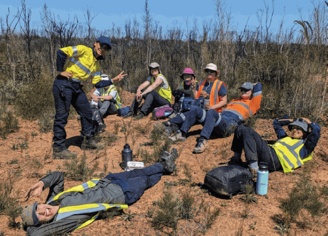
Participants in CAGE 2023.

